ProjectWise Geospatial Management extends the ProjectWise environment with a geospatial view and gives spatial context to any information. Drawings, maps, models, images, vendor specific GIS formats, and business documents in their original intended form can all be related spatially in ProjectWise. This provides a practical and rapidly deployable system of organization, where the common denominator is spatial location. Everything at particular location or area is readily available for you.
Dynamic and interactive map-based interfaces allow users to intuitively navigate and retrieve content based on location. Integrated map management, dynamic coordinate system support, and practical spatial indexing tools provide the means to get up and running quickly, and to routinely incorporate new content from your projects and operations. Information that is already spatially aware, such as georeferenced DGN, images, or other GIS data, is automatically recognized and placed in the appropriate location. For other types of information, a spatial location is inherited from the folder into which it is placed or a map-based interface can be used to define its location.
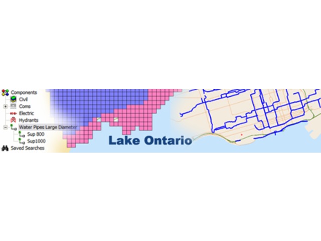
ProjectWise Geospatial Management provides many ways to search for information including spatial and property based queries. Information locations may be visually depicted in a variety of ways on the map interface, including thematic displays. Users can also “see what’s inside” DGN files without opening them and review properties of indexed features or “components.” A search across many DGN documents, provides a seamless view of the desired information.
ProjectWise Geospatial Management users work in an intuitive, natural spatial environment and may also take advantage of all the collaboration, workflow, and security of features of ProjectWise.